On this page
Completed works
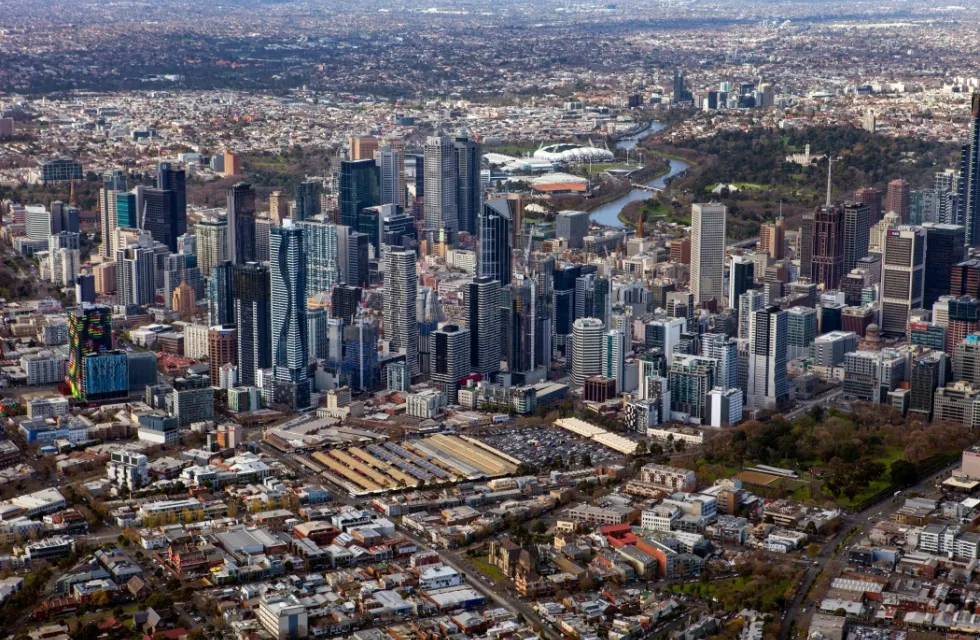
Starting mid-2023, we began installing clearer signs with new parking conditions throughout the central city. We’re now working to install parking improvements in other neighbourhoods across the municipality. To learn more about our neighbourhood parking reviews, and provide your feedback about on-street parking in the City of Melbourne, visit our online engagement portal Participate Melbourne External link.
Want your say on changes in your area?
Complete our neighbourhood parking survey External link.
East Melbourne
Parking improvement works in East Melbourne begin from October 2025.
Visit Participate Melbourne External link to learn more about the improvements and what we heard, including how feedback from the community directly informed these finalised changes.
The map below shows where we'll be making improvements this round.
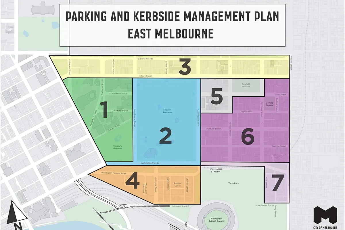
- Area 1 is on the west side of East Melbourne, enclosed by Albert Street to the north, Landsdowne Street to the east, Wellington Parade to the south and Spring street to the west. The area includes MacArthur Street, Gisborne Street, St Andrews Place, Cathedral Place, Treasury Place, and Treasury Gardens.
- Area 2 is enclosed by Landsdowne Street to the west, Albert Street to the north, Clarendon Street to the east and Wellington Parade to the south. It includes all of Fitzroy Gardens, Landsdowne Street, Clarendon Street, and Wellington Parade between Clarendon and Spring streets.
- Area 3 is a narrow area that runs across the north edge of East Melbourne. It is enclosed by Spring Street to the west, Victoria Parade to the north, Hoddle Street to the east and Albert Street to the west. It includes the sections of Victoria Parade and Albert Street between Spring and Hoddle streets.
- Area 4 is the small area south of Treasury Gardens and Fitzroy Gardens, north-west of the Melbourne Cricket Ground. It includes Wellington Parade South, Wellington Crescent, Jolimont Road, Agnes Street, Palmer Street and Charles Street.
- Area 5 is a small area south of Albert Street and east of Clarendon Street. It comprises two blocks bordered by Clarendon, Gills, Powlett and Albert streets, and includes Powlett Reserve.
- Area 6 is on the eastern edge of East Melbourne, bordered by Hoddle Street to the east, Wellington Parade to the south and Clarendon Street to the west. It comprises 12 blocks including all of Hotham, George and Darling streets and Darling Square, and sections of Grey, Gipps, Powlett and Simpson streets.
- Area 7 is a small area at the south-east of the suburb. It comprises the blocks west of Yarra Park including Vale Street, Vale Street South and Berry Street, and the section of Wellington Parade between Clarendon Street and Hoddle Street.
West Melbourne
West Gate Tunnel
The City of Melbourne has been working closely with the Department of Transport and Planning (DTP) ahead of the opening of the West Gate Tunnel later this year.
Before the tunnel opens, we’ve worked with DTP to roll out a range of interim measures in local streets across North and West Melbourne to help ensure these neighbourhoods aren’t used as shortcuts by motorists.
You can find more detail about these changes at Transport Amenity Program External link.
Parking improvement works in West Melbourne will begin from May 2025. Visit Participate Melbourne External link learn more about the improvements and what we heard, including how feedback from the community directly informed these finalised changes.
The map below shows where we'll be making improvements this round.
The downloadable maps below provide an overview of the parking conditions that will apply in each area.
| Area | DOCX | |
|---|---|---|
| Area 1 | 200 KB | 508 KB |
| Area 2 | 935 KB | 350 KB |
| Area 3 | 875 KB | 562 KB |
| Area 4 | 761 KB | 524 KB |
Kensington
Works will update parking conditions to better balance community needs and are the result of parking data analysis and feedback from the Kensington community. The changes we're making are not 'set and forget'. We will review them each year to make sure the new parking conditions are working well.
Works began in November 2024. See what to expect while we work.
Parking conditions will be officially changed as soon as signs are visible on each street.
We’re making gradual adjustments to parking on an annual basis, so not all streets will be changed this round.
The map below shows where we’ll be making improvements this round.
Downloadable maps below provide an overview of the parking conditions that will apply in each area.
You can also read more about the parking improvement initiatives in Kensington as well as residential parking permits in your neighbourhood, including permit types and availability.
| Area | DOCX | |
|---|---|---|
| Area 1 | 700 KB | 906 KB |
| Area 2 | 5.5 MB | 439 KB |
| Area 3 | 15.6 MB | 1.1 MB |
| Area 4 | 164 KB | 427 KB |
| Area 5 | 2.71 MB | 893 KB |
Carlton
Works will update parking conditions to better balance community needs and are the result of parking data analysis and feedback from the Carlton community. External link
Works began in early June 2024 and are due to be completed by quarter 4 2024. See what to expect while we work.
Parking conditions will be officially changed as soon as signs are visible on each street.
We’re making gradual adjustments to parking on an annual basis, so not all streets will be changed this round.
The map below shows where we’ll be making improvements this round.
Downloadable maps below provide an overview of the parking conditions that will apply in each area.
You can also read more about the parking improvement initiatives in Carlton.
| Block | DOCX | |
|---|---|---|
| Queensberry Street, Lygon Street, Victoria Street, Swanston Street | 904 KB | 405 KB |
| Queensberry Street, Rathdowne Street, Victoria Street, Lygon Street | 352 KB | 358 KB |
| Elgin Street, Lygon Street, Faraday Street and Swanston Street | 335 KB | 376 KB |
| Elgin Street, Rathdowne Street, Faraday Street, Lygon Street | 336 KB | 386 KB |
| Grattan Street, Lygon Street, Pelham Street, Swanston Street | 383 KB | 392 KB |
| Grattan Street, Rathdowne Street, Pelham Street, Lygon Street | 362 KB | 369 KB |
| Pelham Street, Lygon Street, Queensberry Street, Swanston Street | 396 KB | 411 KB |
| Pelham Street, Rathdowne Street, Queensberry Street, Lygon Street | 348 KB | 349 KB |
| Faraday Street, Rathdowne Street, Grattan Street and Lygon Street | 379 KB | 404 KB |
| Faraday Street, Lygon Street, Grattan Street and Swanston Street | 349 KB | 357 KB |
| Block | DOCX | |
| Grattan Street, Barry Street, Pelham Street and Elizabeth Street | 289 KB | 243 KB |
| Grattan Street, Leicester Street, Pelham Street and Barry Street | 270 KB | 225 KB |
| Grattan Street, Swanston Street, Pelham Street and Leicester Street | 301 KB | 253 KB |
| Pelham Street, Leicester Street, Queensberry Street and Berkeley Street | 389 KB | 352 KB |
| Pelham Street, Swanston Street, Queensberry Street and Leicester Street | 314 KB | 249 KB |
| Queensberry Street, Leicester Street, Victoria Street and O'Connell Street | 364 KB | 329 KB |
| Queensberry Street, Swanston Street, Victoria Street and Leicester Street | 304 KB | 260 KB |
| Area 1 | DOCX | |
| Faraday Street, Nicholson Street, Carlton Street and Canning Street | 508 KB | 1.7 MB |
| Faraday Street, Canning Street, Carlton Street and Rathdowne Street | 545 KB | 2.4 MB |
| Elgin Street, Nicholson Street, Faraday Street and Canning Street | 487 KB | 1.9 MB |
| Elgin Street, Canning Street, Faraday Street and Rathdowne Street | 530 KB | 1.8 MB |
| Nicholson Street and Victoria Parade | 269 KB | 239 KB |
| Area 2 | DOCX | |
| Palmerston Street, Rathdowne Street, Elgin Street and Lygon Street | 595 KB | 270 KB |
| Keppel Street, Lygon Street, Elgin Street and Swanston Street | 712 KB | 288 KB |
| Princes Street, Rathdowne Street, Kay Street and Lygon Street | 328 KB | 390 KB |
| Cemetery Road East, Lygon Street, Keppel Street and Swanston Street | 313 KB | 322 KB |
| Area 3 | DOCX | |
| Kay Street, Nicholson Street, Elgin Street and Canning Street | 320 KB | 338 KB |
| Kay Street, Canning Street, Elgin Street and Rathdowne Street | 339 KB | 252 KB |
| Princes Street, Nicholson Street, Kay Street and Canning Street | 345 KB | 483 KB |
| Princes Street, Canning Street, Kay Street and Rathdowne Street | 347 KB | 492 KB |
Southbank and Botanic Gardens
Works have updated parking conditions to better balance community needs and are the result of parking data analysis and feedback from the Southbank community External link. These works began in mid-March and were completed in June 2024.
A key principle of these parking improvements is that the changes are not 'set and forget'. As part of our commitment to review them each year to make sure they are working well, we checked in with the Southbank community in November 2024. Following this check-in, we completed further improvement works in January 2025. These included:
- Updating parking time limits to end at 9pm each day in key zones, including 'City Road’ and ‘Coventry’.
- Extending parking time limits from two to three hours in select locations in the ‘City Road’ zone.
- Providing more all-day meter parking spaces in the ‘Coventry’ zone.
See what to expect while we work.
Parking conditions will be officially changed as soon as signs are visible on each street.
The parking plans below detail the parking changes in each block of streets.
Downloadable maps below provide an overview of the parking conditions that will apply in each area.
You can also read more about the parking improvement initiatives in Southbank.
| Block | DOCX | |
|---|---|---|
| Southbank Bvd, St Kilda, Grant, Dodds | PDF 696 KB | DOCX 491 KB |
| Southbank Bvd, Dodds, Grant, Sturt | PDF 1.6 MB | DOCX 425 KB |
| Southbank Bvd, Kavanagh, Power, City Rd | PDF 805 KB | DOCX 424 KB |
| Southbank Bvd, Sturt, Power, Kavanagh | PDF 1.7 MB | DOCX 444 KB |
| Block | DOCX | |
|---|---|---|
| Coventry, Dodds, Dorcas, Kings Way | PDF 753 KB | DOCX 402 KB |
| Grant, Dodds, Miles, Sturt | PDF 875 KB | DOCX 385 KB |
| Grant, St Kilda, Wadey, Wells | PDF 703 KB | DOCX 453 KB |
| Grant, Wells, Miles, Dodds | PDF 3GB | DOCX 341 KB |
| Miles, Dodds, Coventry, Sturt | PDF 746 KB | DOCX 392 KB |
| Miles, Wells, Dorcas, Dodds | PDF 807 KB | DOCX 433 KB |
| Wadey, St Kilda, Coventry, Wells | PDF 1.3 MB | DOCX 607 KB |
| Block | DOCX | |
|---|---|---|
| City, Moray, Westgate | PDF 327 KB | DOCX 513 KB |
| City, Power, Westgate, Kings | PDF 310 KB | DOCX 409 KB |
| Moore, Miles, Kings | PDF 297 KB | DOCX 417 KB |
| Whiteman, Clarendon, City, Westgate | PDF 316 KB | DOCX 507 KB |
| Block | DOCX | |
|---|---|---|
| Alexandra Avenue | PDF 2 MB | DOCX 591 KB |
| Birdwood Avenue and Dallas Brooks Drive | PDF 1.8 MB | DOCX 556 KB |
| Linlithgow Avenue, Birdwood Avenue, Anzac Avenue, and Gov House Drive | PDF 2.1 MB | DOCX 623 KB |
| Adjustments to City Road and Coventry zones | PDF 2.5 MB | DOCX 5.5 MB |
Central city (CBD)
Works to improve parking conditions in the central city were completed from July 2023 to March 2024.
Downloadable maps below provide an overview of the parking conditions that will apply in each area.
You can also read more about the parking improvement initiatives in the central city.
| Block | DOCX | |
|---|---|---|
| Bourke, Exhibition, Collins and Russell | PDF 705 KB | DOCX 277 KB |
| Bourke, Russell, Collins and Swanston | PDF 633 KB | DOCX 317 KB |
| Bourke, Spring, Collins and Exhibition | PDF 685 KB | DOCX 369 KB |
| Bourke, Swanston, Collins and Elizabeth | PDF 319 KB | DOCX 374 KB |
| Collins, Russell, Flinders and Swanston | PDF 238 KB | DOCX 968 KB |
| Collins, Swanston, Flinders and Elizabeth | PDF 371 KB | DOCX 504 KB |
| Collins, Exhibition, Flinders and Russell | PDF 640 KB | DOCX 249 KB |
| Collins, Spring, Flinders and Exhibition | PDF 594 KB | DOCX 268 KB |
| Block | DOCX | |
|---|---|---|
| La Trobe, Exhibition, Lonsdale and Russell | PDF 678 KB | DOCX 369 KB |
| La Trobe, Russell, Lonsdale and Swanston | PDF 640 KB | DOCX 351 KB |
| La Trobe, Spring, Lonsdale and Exhibition | PDF 707 KB | DOCX 390 KB |
| La Trobe, Swanston, Lonsdale and Elizabeth | PDF 565 KB | DOCX 294 KB |
| Lonsdale, Exhibition, Bourke and Russell | PDF 651 KB | DOCX 346 KB |
| Lonsdale, Russell, Bourke and Swanston | PDF 639 KB | DOCX 337 KB |
| Lonsdale, Spring, Bourke and Exhibition | PDF 728 KB | DOCX 362 KB |
| Lonsdale, Swanston, Bourke and Elizabeth | PDF 591 KB | DOCX 300 KB |
| Block | DOCX | |
|---|---|---|
| Collins Street, Elizabeth Street, Flinders Street, Queen Street | PDF 1.2 MB | DOCX 292 KB |
| Collins Street, King Street, Flinders Street, Spencer Street | PDF 1.3 MB | DOCX 273 K |
| Collins Street, Queen Street, Flinders Street, William Street | PDF 541 KB | DOCX 310 KB |
| Collins Street, William Street, Flinders Street, King Street | PDF 1.2 MB | DOCX 315 KB |
| Block | DOCX | |
|---|---|---|
| La Trobe, Elizabeth, Lonsdale, Queen | PDF 1.2 MB | DOCX 265 KB |
| La Trobe, King, Lonsdale, Spencer | PDF 1 MB | DOCX 236 KB |
| La Trobe, Queen, Lonsdale, William | PDF 1 MB | DOCX 242 KB |
| La Trobe, William, Lonsdale, King | PDF 1.2 MB | DOCX 244 KB |
| Lonsdale, Elizabeth, Bourke, Queen | PDF 238 KB | DOCX 968 KB |
| Lonsdale, King, Bourke, Spencer | PDF 371 KB | DOCX 504 KB |
| Lonsdale, Queen, Bourke, William | PDF 640 KB | DOCX 249 KB |
| Lonsdale, William, Bourke, King | PDF 1.2 MB | DOCX 411 KB |
| Block | DOCX | |
|---|---|---|
| Batman, King, La Trobe, Spencer | PDF 535 KB | DOCX 269 KB |
| Dudley, King, Batman, Spencer | PDF 633 KB | DOCX 380 KB |
| Dudley, Peel Flagstaff Gardens, King | PDF 667 KB | DOCX 329 KB |
| Franklin, Elizabeth, La Trobe, Queen | PDF 517 KB | DOCX 287 KB |
| Franklin, Queen, La Trobe, William | PDF 526 KB | DOCX 337 KB |
| Franklin, Russell, La Trobe, Swanston | PDF 763 KB | DOCX 426 KB |
| Franklin, Swanston, La Trobe, Elizabeth | PDF 535 KB | DOCX 319 KB |
| Therry, Elizabeth, Franklin, Queen | PDF 638 KB | DOCX 381 KB |
| Victoria, Exhibition, La Trobe, Russell | PDF 730 KB | DOCX 488 KB |
| Victoria, Franklin, Swanston | PDF 731 KB | DOCX 544 KB |
| Victoria, La Trobe, Exhibition | PDF 566 KB | DOCX 392 KB |
| Victoria, Queen, QVM, Peel | PDF 791 KB | DOCX 538 KB |
| Victoria, Swanston, Franklin, Elizabeth | PDF 689 KB | DOCX 460 KB |
| Block | DOCX | |
|---|---|---|
| City Road, Fanning Street, Kavanagh Street, Southbank Boulevard | PDF 688 KB | DOCX 413 KB |
| Riverside Quay, Southgate Avenue, City Road, Southbank Boulevard | PDF 538 KB | DOCX 392 KB |
| Southgate Avenue, Southgate Avenue, City Road, Southgate Avenue | PDF 561 KB | DOCX 402 KB |
| Whiteman Street, Kings Way, City Road, Clarendon Street | PDF 587 KB | DOCX 354 |
| Whiteman Street, Power Street, City Road, Kings Way | PDF 577 KB | DOCX 358 KB |
As part of our works to install clearer signs with new parking conditions, we’ve also simplified the traffic conditions for CBD clearways:
- Flinders Street (between Spencer and Russell streets). We’ve removed this clearway section because it was no longer needed. ‘No stopping’ areas remain in sections of Flinders Street to support peak periods.
- Spencer Street. We’ve removed a section of the northbound clearway (between Flinders and Collins streets) to accommodate current road conditions and changes to bus operation.
- Lonsdale Street (between Spencer and Spring streets). We’ve changed the clearway operating times to 7am to 10am Monday to Friday (westbound), and 4pm to 7pm Monday to Friday (eastbound).
- Queen Street (between Lonsdale and Flinders streets). We’ve changed the PM clearway operating times to 4pm to 7pm Monday to Friday (southbound).
What to expect while we work
While we install new parking signs, line markings and other assets to roll-out the improved parking conditions in a neighbourhood, we'll minimise disruption and keep as many parking spaces available as possible:
- Work hours will be 7am to 5pm Monday to Friday.
- Temporary No Stopping signs will be put up in work areas to keep parking bays clear of public vehicles to allow our contractors to do this work quickly. These signs will be removed when our works are complete.
- We'll maintain pedestrian and vehicle access at all times while works are underway.
- We'll notify residents and businesses before works start.
Learn more about how we're making parking simpler, more available and reliable.
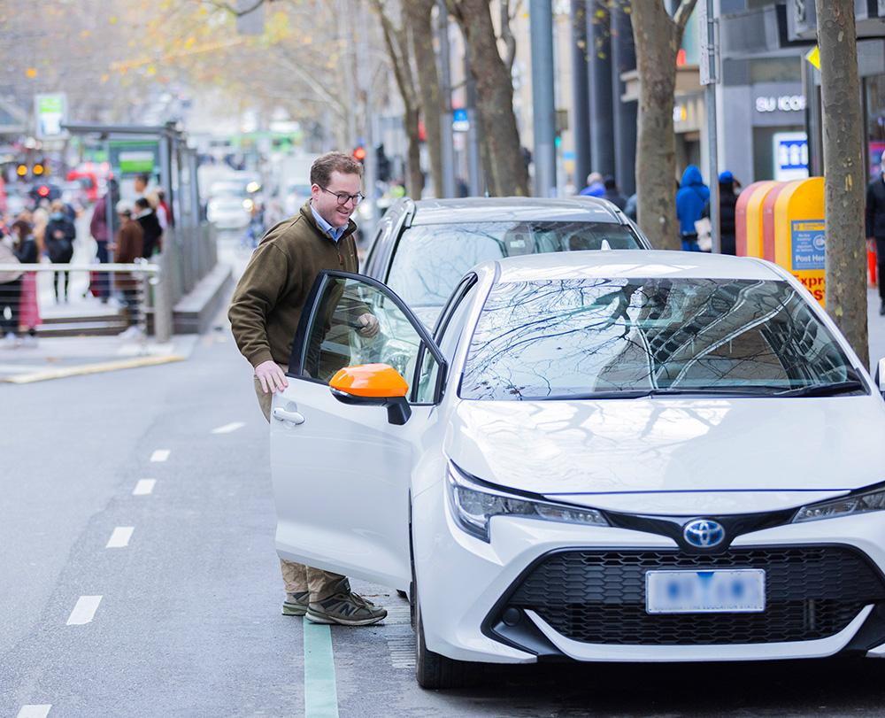
Always check the signs when you park to understand what restrictions apply.

